Marine Geophysical and Hydrographic Surveys
Hydrography and Geophysics are central to any site investigation or seabed mapping project. A hydrographic survey is usually focussed on obtaining high quality bathymetric data of the seabed. A geophysical survey typically involves a number of data requirements including water depths, seabed topography, seabed and sub-seabed obstructions, seabed soils, shallow geology and ground conditions and identification of any man-made and naturally occurring hazards that may adversely impact the objective of the site investigation (geohazards).
Gardline has been providing hydrographic and geophysical survey services for more than 40 years. Operating one of the largest fleets of permanently mobilised survey vessels in the world. Gardline has the global experience, knowledge and resources needed for any marine site survey investigation.
Gardline owns and operates every one of its vessels and directly employs its entire staff on a permanent basis thus ensuring a consistent, efficient, safe and high quality service to its clients. Where extra capacity is called for, Gardline can rely on the partnerships it has built with its group company's and affiliated organisations. Overall Gardline is able to offer planning, acquisition, processing and interpretation on either a regional or localised scale.
Acquisition of hydrographic and geophysical data primarily uses a range of acoustic-based instruments to characterise the seabed, shallow soils and geology. Magnetic and gravimetric systems are also used which sense local variations in the earths magnetic and gravity field.
A variety of ground truthing methods are often undertaken subsequent to or during a geophysical survey, such as seabed geotechnics using a range of sampling systems, environmental sampling of the water-column and seabed and visual investigation using drop down camera and ROV systems.
Gardline's hydrographic and geophysical services are based on the most up to date and efficient acquisition systems available onboard our fleet of dedicated survey ships:
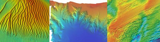
Swathe bathymetry systems. Shallow water high resolution (200-400khz). Medium depth (70-100khz). Ocean depth (12-50khz).
2D and 3D seismic recording, ranging from single channel, 24-48 channel Ultra High Resolution, 96 channel High Resolution to 480 channel exploration seismic hydrophone arrays.
A range of air gun sources to suit all applications from 10-1,980 cu in.
High capacity seismic sources: 1-5 KJ boomer and sparker sources.
Single channel sub-bottom profiler systems including pinger, sparker and boomer.
Side scan sonar systems from 100khz - 1600khz.
Magnetometer and gradiometer systems.
Surface and sub-surface navigation systems.
Acquisition and data storage systems.
Onboard data processing, interpretation and reporting systems.
A particular area of expertise is conducting single pass, integrated surveys gathering multiple datasets simultaneously thus reducing time and cost to the client.
All data acquired is quality controlled onboard for fitness for purposes according to Gardline's Quality Assurance System. Data can be processed, interpreted and reported onboard according to Client requirements, to provide early identification of features or isues of interest to the project.