Geographic Information Centre
The Geographic Information Centre (GIC) contains:
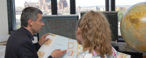
Geographic Information System Suite
There are 10 workstations in the GIS suite which is devoted to GIS and advanced statistics. There is also a Digitisation Suite which contains a large format roller scanner (Cougart x36), an A3 flatbed scanner, an A0 digitising tablet, two A3 colour printers and a server. These facilities allow older, hard-copy material to be used within the GIS environment. Access to Ordnance Survey digital data is achieved by the EDINA Digimap service. ArcGIS and Idrisi software are used for GIS work; whereas SPSS, Minitab and MLwin are the statistical packages used.
The Map Collection
This is a large reference collection of approximately 100,000 maps. The maps are accessed via the Map Curator. An outline of the contents of this collection follows:
Complete sets of Ordnance Survey small scale to 1:25,000 are held;
1:10,000/10,560 for Britain; 1:2,500 and 1:1,250 for Liverpool. County Series 1:2,500 for Merseyside and 1:10,560 for Lancashire, Cheshire, Devon, Somerset and Cornwall, some sheets elsewhere. Historical county and town plans; thematic maps: geology, soils (with memoirs), land use, administrative, etc.; current town plans.
Europe: Unesco and FAO thematic map series; War Office GSGS and other series at one or more scales. German ethnographic 1:200,000 (East/Central Europe, 1930-41).
Africa: Directorate of Overseas Surveys (DOS) and Institut Géographique National material, some early 20th century material, East Africa 1:250,000, ORSTOM soil memoirs.
Asia: Early 20th century Survey of India; AMS U502 1:250,000; DOS small scale mapping.
Americas: Canada 1:500,000, 1:250,000; USA selected sheets (all scales); DOS Caribbean; Brazil 1:500,000; Peru 1:250,000, Haiti 1:100,000 Guatemala 1:250,000, Costa Rica 1:200,000.
Australasia: Some national mapping for Australia and New Zealand; DOS Pacific islands.
The Atlas collection
There are over five hundred volumes in the Atlas collection which is housed in Room 511. These range from general world atlases, to national atlases, to thematic atlases. A hand list of titles can be obtained from the Map Curator.
The Thesis and Dissertation Collections
A copy of all doctoral and masters thesis that are completed within the department is kept in Room 511. The undergraduate dissertations are retained for a year, after which the lecturers indicate which they would like to be kept for a further nine years. A hand list of titles is kept by the Map Curator
The Aerial Photograph Collection
This comprises mostly greyscale planimetric cover of the UK (i.e. the local area plus field work sites) and parts of France, Portugal, Spain, Canada, Cyprus, Nigeria and Zambia. Mirror stereoscopes are available for use.
The Jensen Dee Archive
This comprises material collected by H.A.P. Jensen on the Dee estuary for an MA thesis. In 1953 Jensen died in a railway accident and his notes and maps were deposited in the department.