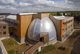
British Geological Survey: Marine Geoscience

The British Geological Survey (BGS) is a world-leading geological survey. It focuses on public-good science for government, and research to understand earth and environmental processes.
It is the UK's premier provider of objective and authoritative geoscientific data, information and knowledge to help society to:
use its natural resources responsibly
manage environmental change
be resilient to environmental hazards
The BGS provides expert services and impartial advice in all areas of geoscience. Our client base is drawn from the public and private sectors both in the UK and internationally.
The purpose-built facilities at the Lyell Centre will enable the BGS and Heriot-Watt University (HWU) to build on their expertise in land and marine conservation, geology and geoscience.
Staff data is for 2017/18
Funding by Source
| Funding Proportion | |
|---|---|
| Natural Environment Research Council | 40-59% |
| Foreign (other than EC contracts) | 40-59% |
| Other public sector | 0-19% |
| Government departments | 0-19% |
| UK private sector | 0-19% |
| European Community | 0-19% |
Consultancy Services and Products
| Contact | |
|---|---|
| CO2 Storage Site Appraisal | Chris Gent |
| Coastal Geology & Processes Analyses | Andres Payo |
| Geological mapping | Emrys Phillips |
| Geoscience services and advice | Dave McCarthy |
| Macro- and microscale analysis of deformed geological materials | Emrys Phillips |
| Marine Engineering Geology and Infrastructure | Gareth Carter |
| Marine Geohazard Assessments | Gareth Carter |
| Modelling of Coastal Systems & Water Resources | Andres Payo |
| Petrology | Emrys Phillips |
| Project management for scientific drilling projects | Dave McInroy |
| Seafloor / Geomorphology Mapping | Rhys Cooper |
| Seimsic interpretation and geo-model/ground model development | Emrys Phillips |
| Shallow water survey | Rhys Cooper |
| Source Rock Analysis using Geophysical Well Logs | Chris Gent |